About Cycle South Armagh
Cycle South Armagh is a free guide to riding a bike in South Armagh and the Ring of Gullion. Whether you're visiting, or local and looking for something new, there was never one place to find it all: which roads to take, where to stop for coffee, where to get a puncture fixed, where to grab a pint after the ride or stay the night. So we brought it together here.
You'll find cycling routes with real GPX files to download, a coffee stop on every route, and the pubs, things made in South Armagh, saunas, places to stay and useful services that go with them. Every route starts in, or passes through, South Armagh, and each one takes its name from local folklore or place names, from The Ring Dyke to The Sunny Port.
For a long time South Armagh was one of Ireland's best-kept secrets, passed by on the road between Belfast and Dublin. That's changing fast. It's a landscape steeped in history and folklore: the volcanic Ring of Gullion, an Area of Outstanding Natural Beauty; passage tombs, dolmens and old churches; and the stories of Fionn mac Cumhaill, Cú Chulainn and the Táin. Slieve Gullion Forest Park has grown from fewer than 30,000 visits a year to nearly half a million, Killeavy Castle has reopened as a hotel at the foot of the mountain, and new cafés, glamping sites and saunas keep opening in the villages. Quiet roads, big views and a warm welcome: it's a brilliant place to cycle.
The site is a work in progress and will keep growing. If you know a route, a café or a hidden gem that should be on it, please make a suggestion.
Twelve Years on the Bike
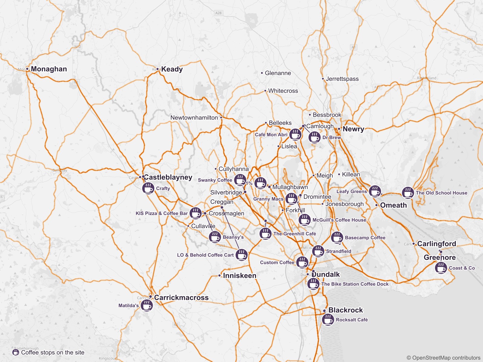
The routes here come from cycling these roads for years. This heatmap shows every bike ride I've logged around South Armagh since 2014, 323 of them. Darker lines are roads I've cycled more often, and the cups are the coffee stops listed on this site.
Where Is South Armagh?
South Armagh isn't an official area with a boundary on a map. It's the southern part of County Armagh, around Slieve Gullion and the Ring of Gullion, made up of about 200 old townlands. Its main towns and villages are Belleeks, Bessbrook, Camlough, Crossmaglen, Cullaville, Cullyhanna, Dromintee, Forkhill, Jerrettspass, Jonesborough, Killean, Lislea, Meigh, Mullaghbawn, Newtownhamilton, Silverbridge and Whitecross.
If you'd like to find out more, the council's booklet The Townlands of South Armagh (PDF) lists every townland with its Irish name and what it means.
Everything we list is chosen with South Armagh at its heart. Our routes start here and often go further, so you'll also find coffee stops and sights out in the rest of Armagh and in Down, Louth and Monaghan, where a ride takes you there.
Our Supporters
The site is free and listings are never paid for. These local organisations have chipped in towards stickers, route cards and rides:
Slieve Gullion Credit Union
Forkhill's credit union, who gave £200 towards our first stickers. Thank you!
Make a Suggestion
Know a route, café, pub, local maker or producer, sauna, place to stay, service, club, social spin, bike tour, thing to do or event that should be here? We focus on South Armagh, plus places on our routes just beyond it. Fill this in and it opens as an email to us, ready to send from your own mail app. For anything else, see Contact Us.